
Welcome to the new home of Lehigh Valley Public Media.

If you’re looking for LehighValleyNews.com, you’re in the right place — welcome to Lehigh Valley Public Media, your source for trusted local news, newsletters, and community connection.
Local News

Forecasters warn of overnight flash flooding threat for the Lehigh Valley

As the assessment of damage and cleanup continues from last weekend’s storms, forecasters are warning of another overnight flash flooding risk for the Lehigh Valley.

Excessive rain
This graphic shows the excessive rainfall risk for the region Thursday night into Friday morning.
Sponsorship

BETHLEHEM, Pa. — As damage assessment and cleanup continues from last weekend’s storms, forecasters are warning of another overnight flash flooding risk for the Lehigh Valley.

This scene, which looks like a waterfall, did not exist until recent floods. The water eroded a section of the land and creat
This scene, which looks like a waterfall, did not exist until recent floods. The water eroded a section of the land and created it. Julian Abraham
Upper Mt. Bethel Twp. Manager Ed Nelson drives his work vehicle, scouting out damage from the flooding.
Upper Mt. Bethel Twp. Manager Ed Nelson drives his work vehicle, scouting out damage from the flooding. Julian Abraham
Township workers repair the damage to the roads near the local auction house. During flooding, much of this area was complete
Township workers repair the damage to the roads near the local auction house. During flooding, much of this area was completely underwater. Julian Abraham
Twenty-two year-old Nick Nittoli stands in front of his work crew. He explained that their job today is essentially to dig ou
Twenty-two year-old Nick Nittoli stands in front of his work crew. He explained that their job today is essentially to dig out trenches and fill them up with stone to minimize future flooding. Julian Abraham
Giant rocks moved by the water, luckily leaving the drain pipe unblocked.
Giant rocks moved by the water, luckily leaving the drain pipe unblocked. Julian Abraham
This pipe was once covered with rocks and land, but floods washed it away, leaving it bare.
This pipe was once covered with rocks and land, but floods washed it away, leaving it bare. Julian Abraham
Several of many fallen trees in Upper Mt. Bethel.
Several of many fallen trees in Upper Mt. Bethel. Julian Abraham
Lindsey Manzi leads the public works department in Upper Mt. Bethel. He said 'we're up against a lot' as his team finished pr
Lindsey Manzi leads the public works department in Upper Mt. Bethel. He said 'we're up against a lot' as his team finished preparing the area for future floods today. Julian Abraham
A man mows his lawn, avoiding the flooded area.
A man mows his lawn, avoiding the flooded area. Julian Abraham
Inside the Township's garage, work is all done for the day.
Inside the Township's garage, work is all done for the day. Julian Abraham
Ed Nelson thanks his crew for a job well done.
Ed Nelson thanks his crew for a job well done. Julian Abraham

The area is at a slight (2 out of 5) risk of excessive rainfall and a marginal risk (1 out of 5) of severe weather.

  • The National Weather Service is warning of another flash flood risk for the Lehigh Valley
  • Excessive rainfall could come in the 3 to 5 a.m. timeframe on Friday
  • It comes days after flash flooding caused extensive damage in parts of Northampton County

The most likely scenario has storms moving through the region between 3 to 5 a.m. Friday — roughly the same timeframe when heavy downpours inundated the region last Sunday.

https://twitter.com/NWS_MountHolly/status/1681959996597370880?s=20

The setup

According to the National Weather Service in Mount Holly, New Jersey, a developing storm system will continue moving eastward across the lower Great Lakes, “driven by a potent disturbance in the upper levels that will start to take on a neutral to negative tilt.”

A negative tilt often is a sign of a developing or intensifying system, and as this one approaches, forecasters say a warm front will continue to lift back northward into the region.

Main threats

Because of the timing of the storms, there will be a limiting factor for damaging winds. But flash flooding will be of greater concern, with precipitable water around 2 inches.

Areas near and northwest of the Interstate 95 corridor, including the Lehigh Valley, will be at risk for excessive rainfall and localized flash flooding “by the latter part of the overnight period,” the NWS forecast discussion said.

Very heavy downpours are expected in some areas well before sunrise.

Flash flood awareness at night

Flash flooding at night is even more dangerous, because it’s harder to recognize flood dangers in the dark. Rising water can’t be spotted and cars may drive into water of an unknown depth, and rapidly rising water may engulf vehicles and their occupants.

Those in flood-prone areas are urged not to park along or near streams or creeks, particularly during threatening conditions.

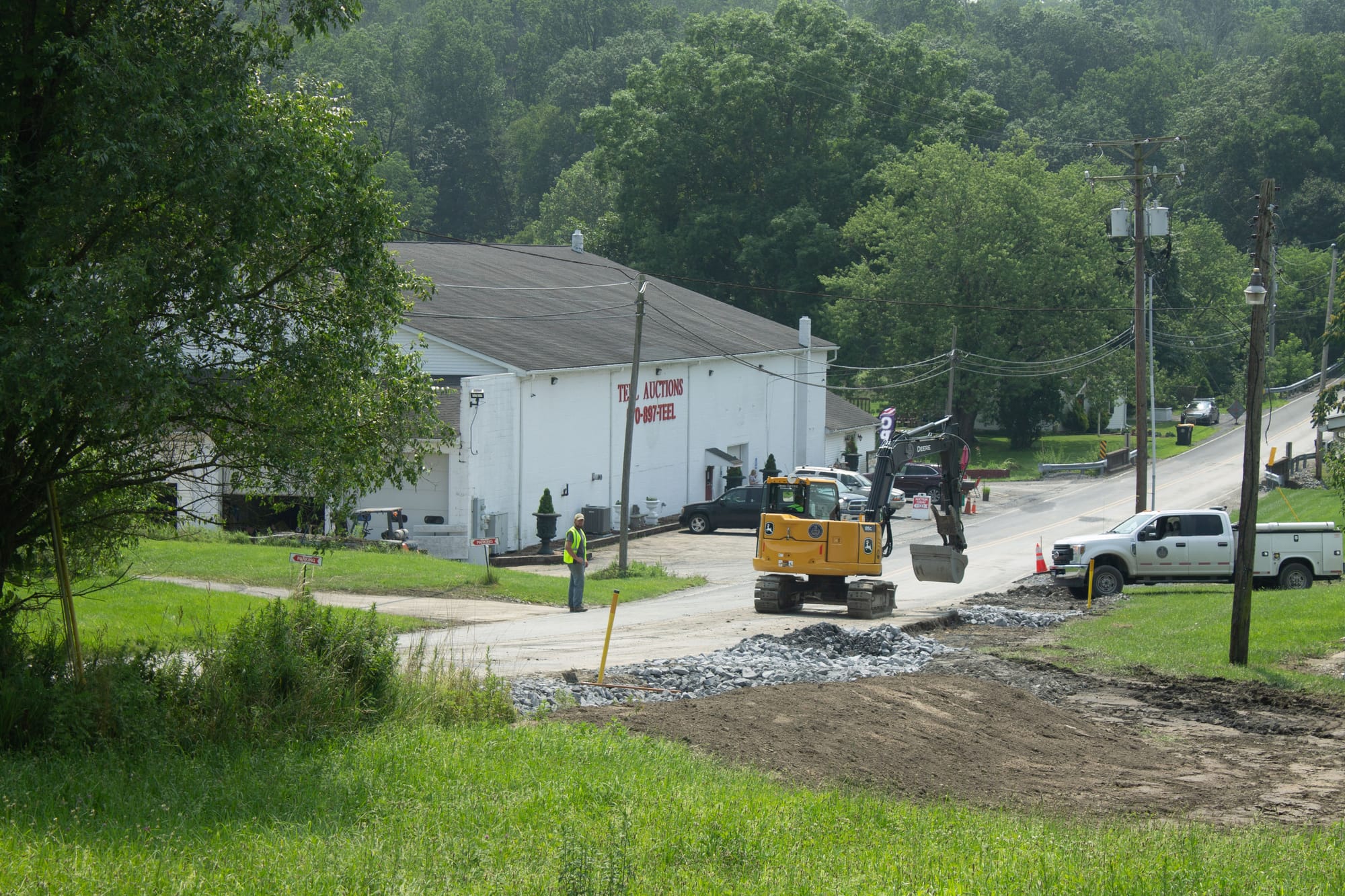
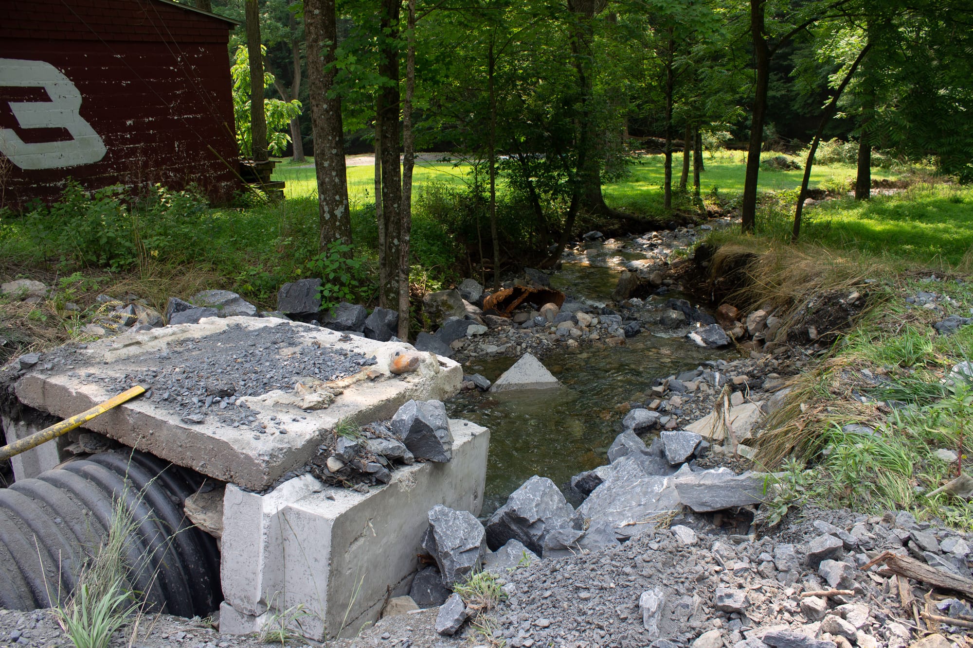
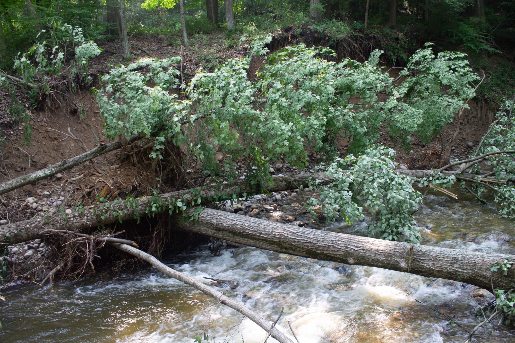
Following heavy rainfall and flash flooding over the weekend, Northampton County Emergency Management Services has spent time this week compiling an inventory of damages reported by municipalities.
PHOTOS: Upper Mount Bethel floodingMore than 4 inches of rain fell in parts of eastern Northampton County in just a few hours.

The county's northern tier was hit hard. Four Slate Belt municipalities have enacted disaster declarations — Bangor, Lower Mount Bethel Township, Plainfield Township and Washington Township.

Share
Sponsorship