
Welcome to the new home of Lehigh Valley Public Media.

If you’re looking for LehighValleyNews.com, you’re in the right place — welcome to Lehigh Valley Public Media, your source for trusted local news, newsletters, and community connection.
Local News

The average warmest month of the year is here. What will it mean for the Lehigh Valley?

The Climate Prediction Center is favoring warmer than normal temperatures for the Lehigh Valley, which has an average daily high of 86.4 degrees in July, according to data from the National Weather Service.

Storm damage
Children mill about a 60-foot maple tree that was unearthed and fell across Woodmont Drive in West Bethlehem during a storm that battered the Lehigh Valley on June 26.
Sponsorship

BETHLEHEM, Pa. — After a long-duration heat wave and eight days during which temperatures topped 90 degrees in June, it’s time to look ahead to the average warmest month of the year.

Charlie Gimbar of Green Shadow Tree Service of Lower Saucon Township uses a chainsaw at West Union Boulevard in Bethlehem to
Charlie Gimbar of Green Shadow Tree Service of Lower Saucon Township uses a chainsaw at West Union Boulevard in Bethlehem to clear away pieces of a tree that broke off during the storm Wednesday night. Phil Gianficaro
Wednesday night’s storm tore off chunks of a large tree that landed on the home and vehicles at Pennsylvania Avenue and Robin
Wednesday night’s storm tore off chunks of a large tree that landed on the home and vehicles at Pennsylvania Avenue and Robin Way in West Bethlehem. Phil Gianficaro
Trees down at Beverly Ave and Homestead Ave in Bethlehem.
Trees down at Beverly Ave and Homestead Ave in Bethlehem. Christine Sexton
Windows blew out of a home hit by a tree at Ridgelawn Ave and E. Rosemont Dr. in Bethlehem.
Windows blew out of a home hit by a tree at Ridgelawn Ave and E. Rosemont Dr. in Bethlehem. Christine Sexton
City workers along W. Union Blvd. in west Bethlehem begin the long process of cleaning up after Wednesday night’s powerful st
City workers along W. Union Blvd. in west Bethlehem begin the long process of cleaning up after Wednesday night’s powerful storm. Christine Sexton
A homeowner on Homestead Ave in Bethlehem cleans up after Wednesday's storm.
A homeowner on Homestead Ave in Bethlehem cleans up after Wednesday's storm. Christine Sexton
Trees litter a property at Beverly and Homestead Avenues in Bethlehem following Wednesday's storm.
Trees litter a property at Beverly and Homestead Avenues in Bethlehem following Wednesday's storm. Christine Sexton
Paul Ave and W Union Blvd in Bethlehem.
Paul Ave and W Union Blvd in Bethlehem. Christine Sexton
Parts of a tree lay on Westwood Rd off of Eaton Ave in Bethlehem.
Parts of a tree lay on Westwood Rd off of Eaton Ave in Bethlehem. Christine Sexton
A tree lays on N Ulster Street in Allentown following Wednesday's severe storms.
A tree lays on N Ulster Street in Allentown following Wednesday's severe storms. Stephanie Sigafoos
Trees litter a backyard and a pool area at a home in the west end of Bethlehem.
Trees litter a backyard and a pool area at a home in the west end of Bethlehem. Christine Sexton
Trees lay on power lines on a street in the west end of Bethlehem.
Trees lay on power lines on a street in the west end of Bethlehem. Christine Sexton

As expected, it’s likely to be a scorcher for the Lehigh Valley.

The Climate Prediction Center is favoring warmer-than-normal temperatures for the area, which has an average daily high of 86.4 degrees in July, according to data from the National Weather Service.

The good news is that average monthly rainfall stands at 5.30 inches, and the Lehigh Valley certainly has some catching up to go after measuring just 2.27 inches in June — or 2.13 inches below normal.

According to the weather service, our rain chances appear to be a bit better than they were in June. That includes the daily potential for showers and thunderstorms in the back half of the week, in the July 4-7 time frame.

The seven-day outlook from the Weather Prediction Center highlights the chance for close to an inch of rain over that time frame in the Lehigh Valley area, while locations to our south have the potential to pick up even more.

NOAA model blends tell the same story, with hotter-than-normal temperatures to go with that uptick in precipitation.

June recap

The first month of summer truly brought the heat, with several locations in the Mid-Atlantic and Northeast experiencing record warm temperatures.

Four major climate sites had their hottest June on record, according to the Northeast Regional Climate Center, and others tied their all-time-warmest low temperatures on record during a mid-month heat wave.

The Lehigh Valley had several records of note, with a record high low temperature of 71 degrees on June 24, tying the previous record highest minimum temperature set in 2017.

The temperature also soared to 98 and 96 degrees at Lehigh Valley International Airport on June 22-23, breaking the previous daily records of 95 degrees set in 1965.

Overall, with an average temperature of 72.7 degrees, it was the area’s sixth-warmest June ever.

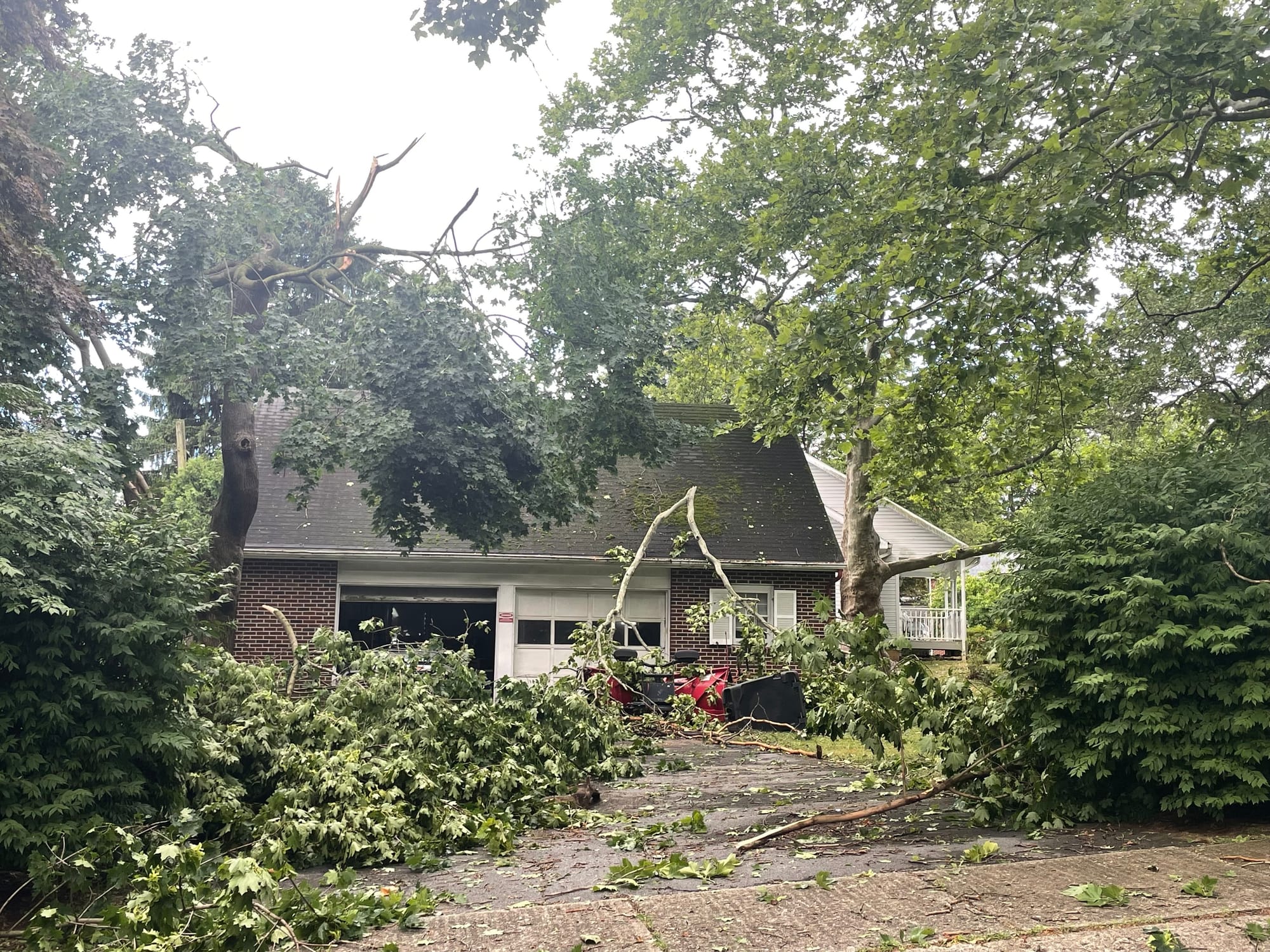
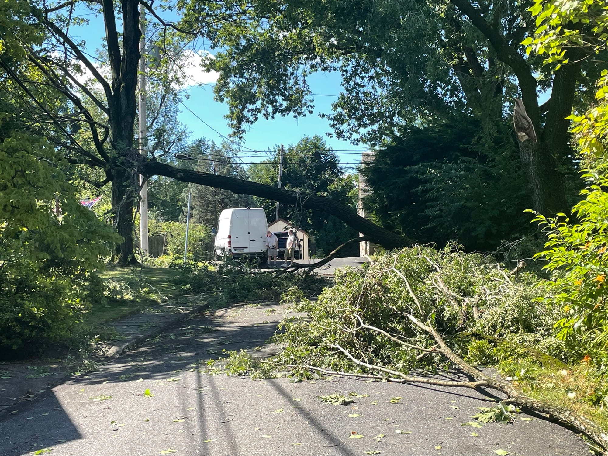
With the hot spell, the month also featured multiple rounds of severe weather, with some storms producing damaging wind gusts that toppled trees and ripped down power lines.
UntitledOn Monday, PPL Electric said the last two weeks of the month produced storms that affected more than 250,000 customers in its service territory.

It also called the storm on June 26 “the most impactful of 2024.”

“We saw more than 1,300 individual damage locations and more than 150,000 customers lose power,” a Facebook post said, with widespread damage creating a multi-day restoration effort.

The utility said it brought in nearly 1,000 workers from outside the company to assist because of the extent of the damage the storm caused, and that it remains focused on minimizing future outages.

Year-to-date

Thanks to a hot and dry June, 2024 now is on pace for the fourth-hottest year on record for the Lehigh Valley, measuring the period of Jan. 1-June 30.

It’s also the 16th-wettest year on record thus far, with 25.39 inches of precipitation, or 3.81 inches above normal.

Share
Sponsorship